Learn by designing
Apply ecological and spatial concepts to a real or fictional site and planting plan.
For education and collaborative projects
Use one visual project to connect plant research, spatial design, access, growth over time, analysis and implementation in lessons, workshops and community processes.
Why it helps
A visual project translates abstract layers, functions and plant characteristics into concrete decisions. Participants can compare alternatives, inspect what an algorithm considered and discuss what still requires observation or judgement.
Apply ecological and spatial concepts to a real or fictional site and planting plan.
Use the public database and advanced filters before participants create an account.
Change density, objectives and growth horizons, then discuss why the resulting proposals differ.
Explore plant growth, seasonal harvest and modelled shade across different moments of the year.
Move from plant functions and access design to inventories, purchasing and implementation information.
Use the mapped project, annotations and presentations as a basis for group review and reflection.
From start to result
Start with what you know and refine the project as new information becomes available.
Give the group a project brief with goals, known conditions and open uncertainties.
Research plants, create recipes, generate or draw layouts and run focused design checks.
Explain the final system, the assumptions behind it and what would need verification on site.
Product views
See AgroForest Designer in action with a sample project.
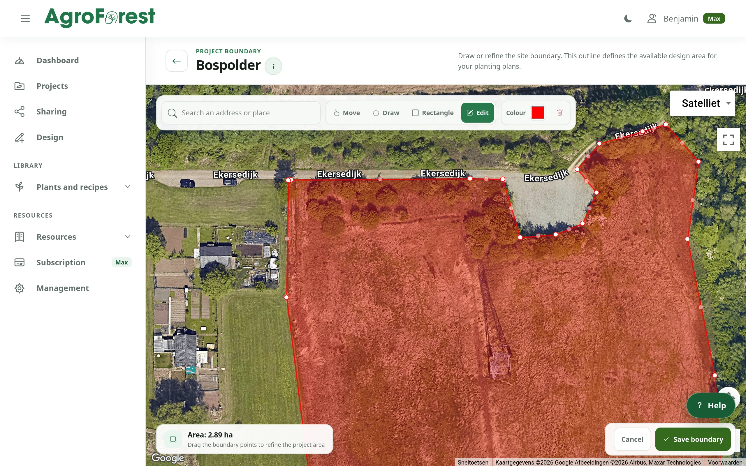
Product capture
Set the project area against real-world imagery before developing the planting plan.
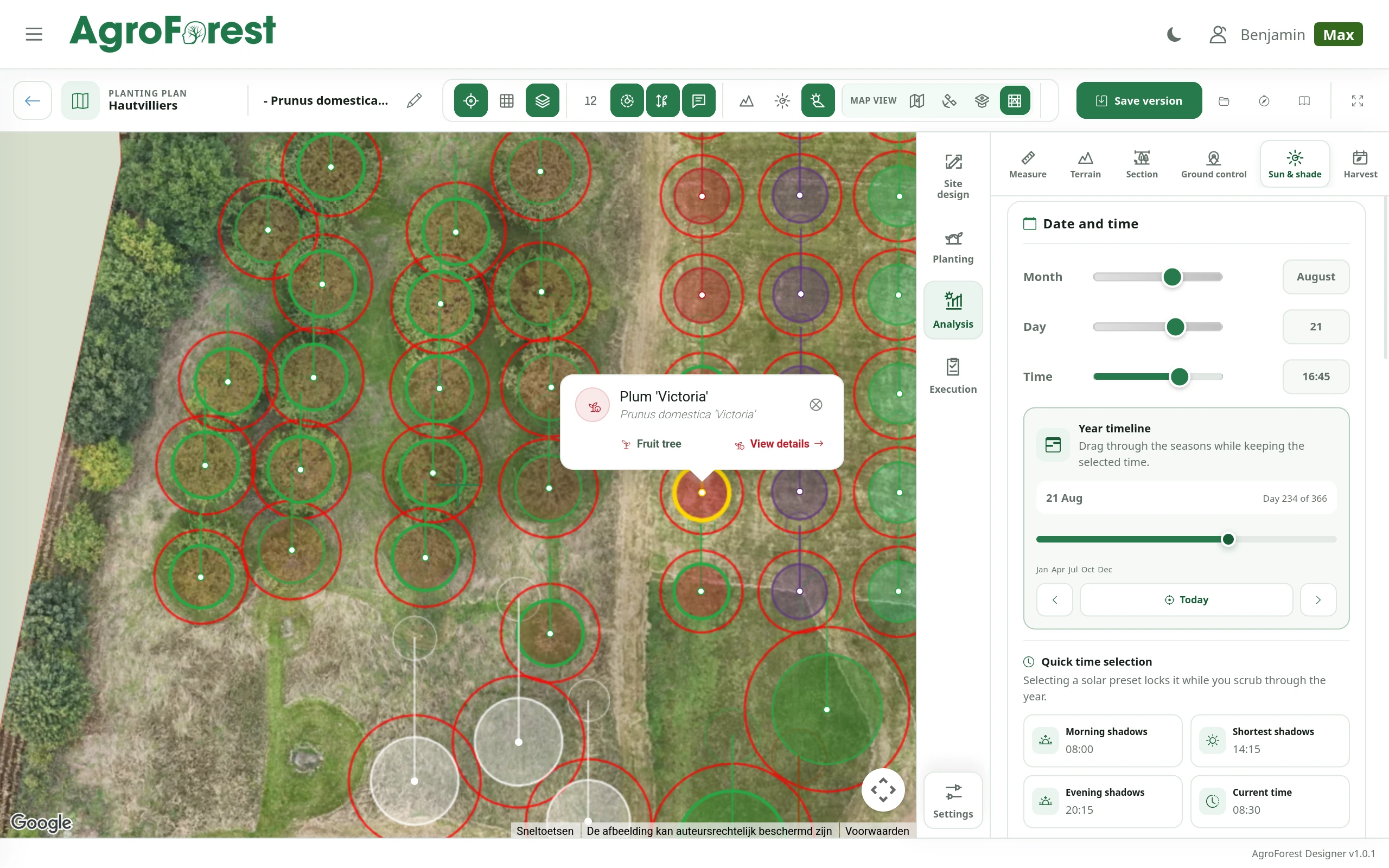 Product capture
Review plant positions, mature spread and layout directly on the aerial image.
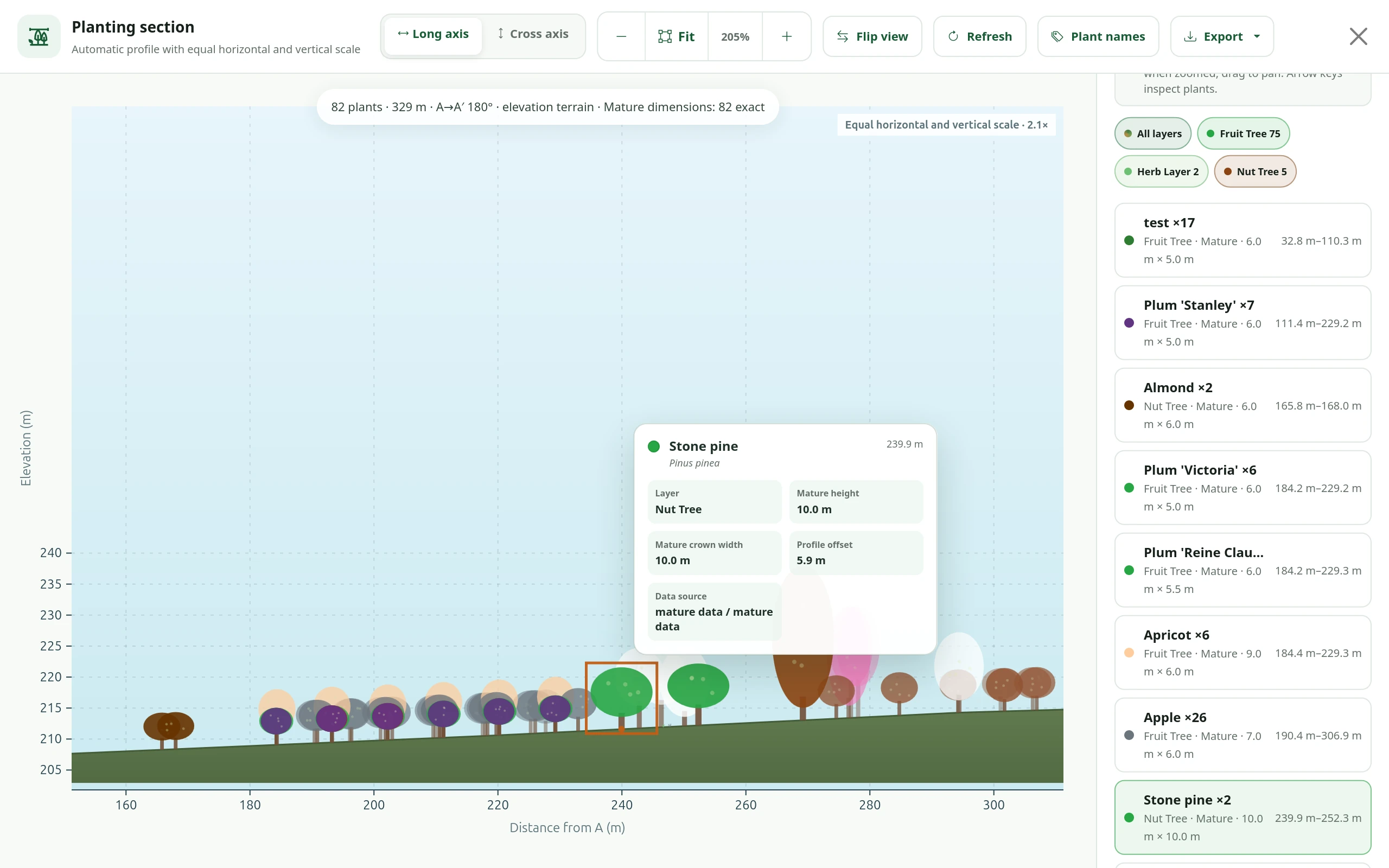 Product capture
Review mature plant heights, crown widths and terrain elevation together in an exportable profile view.
FAQ
Yes. Projects can support exercises from public plant research to complete site design and critical review of generated layouts.
Yes. Visual plans provide a shared object for discussion and decision-making.
Contact us to discuss the needs of an educational or nonprofit organisation.
Your design starts here
Start without payment details. Add capacity or professional features later, when your project needs them.