Follow the sun
Move through dates and times to inspect sun direction and the shadows cast by mapped plants and raised design objects.
Review before you implement
Make elevation, shade, plant spacing, access and harvest timing visible before you commit to purchasing or installation, then prepare the output needed for the next project phase.
Why it helps
Plant dimensions, access, sunlight, terrain relief and seasonal harvest all influence the usefulness of a design. Connected review tools help you identify potential conflicts and missing information while the plan is still easy to change.
Move through dates and times to inspect sun direction and the shadows cast by mapped plants and raised design objects.
Compare a selected day, growing season or year overview and flag plants whose recorded light needs may not match.
Generate labelled elevation contours and adjust their interval, colour and visibility for the site.
Measure distances and areas, inspect plant spacing and run design checks on the path network.
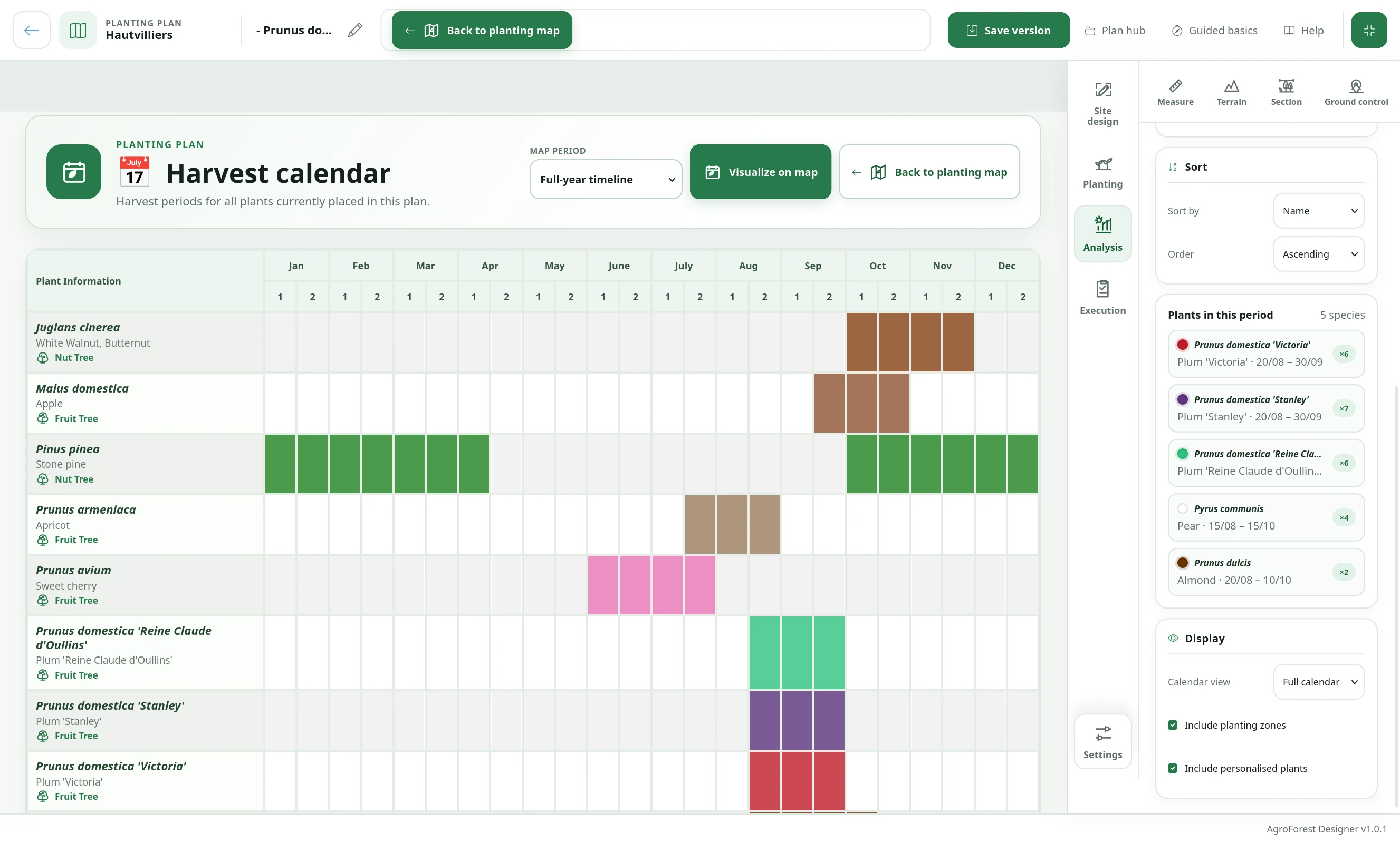
Compare harvest periods across selected plants and identify quieter or concentrated periods.
Create inventories, PDFs, technical output and selected spatial or 3D exports for implementation and communication.
From start to result
Start with what you know and refine the project as new information becomes available.
Add the site boundary, relevant objects, paths and the plants you want to assess.
Inspect elevation, sunlight, modelled shade, spacing, access and harvest timing as separate design questions.
Adjust the plan or gather missing local information instead of treating an automated result as final proof.
Prepare a readable plan, plant information or professional export for the people handling the next phase.
Connected review tools
Each analysis answers a different question. Use them together with site observation and professional judgement rather than as a substitute for local verification.
Select a date and time or move through the year to understand how the sun direction changes around the plan.
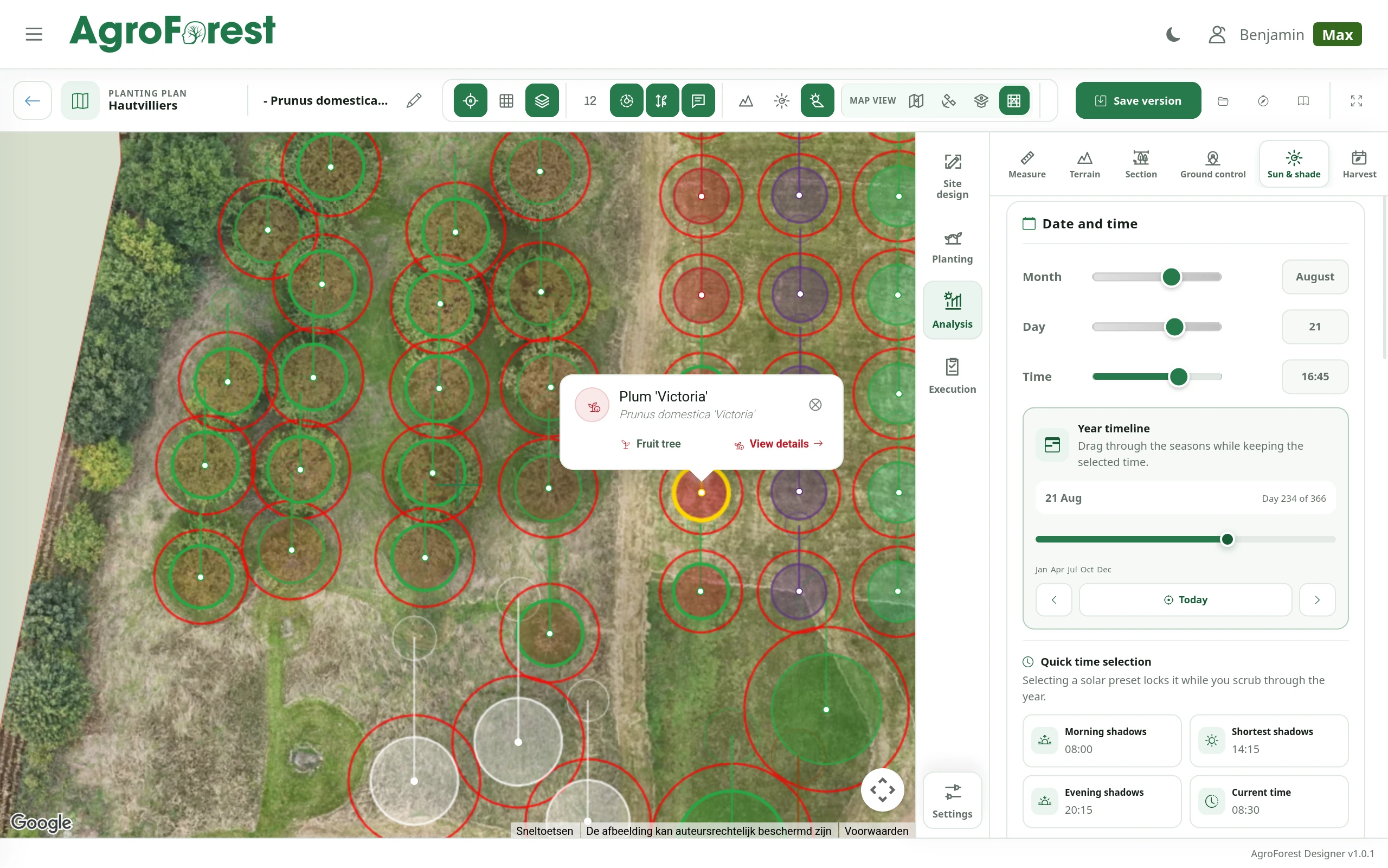
Sample daylight positions to create a practical shade overview and compare it with recorded plant-light preferences.
Bring sampled terrain elevation into the plan as an adjustable contour overlay.
Keep dimensions attached to the mapped plan while checking how access and planting elements interact.
Translate positioned plants into seasonal and practical information for implementation planning.
Choose an output that fits a site team, client discussion or downstream professional workflow.
Product views
See AgroForest Designer in action with a sample project.
Product capture
Compare harvest periods across selected species and spot gaps in the year.
 Product capture
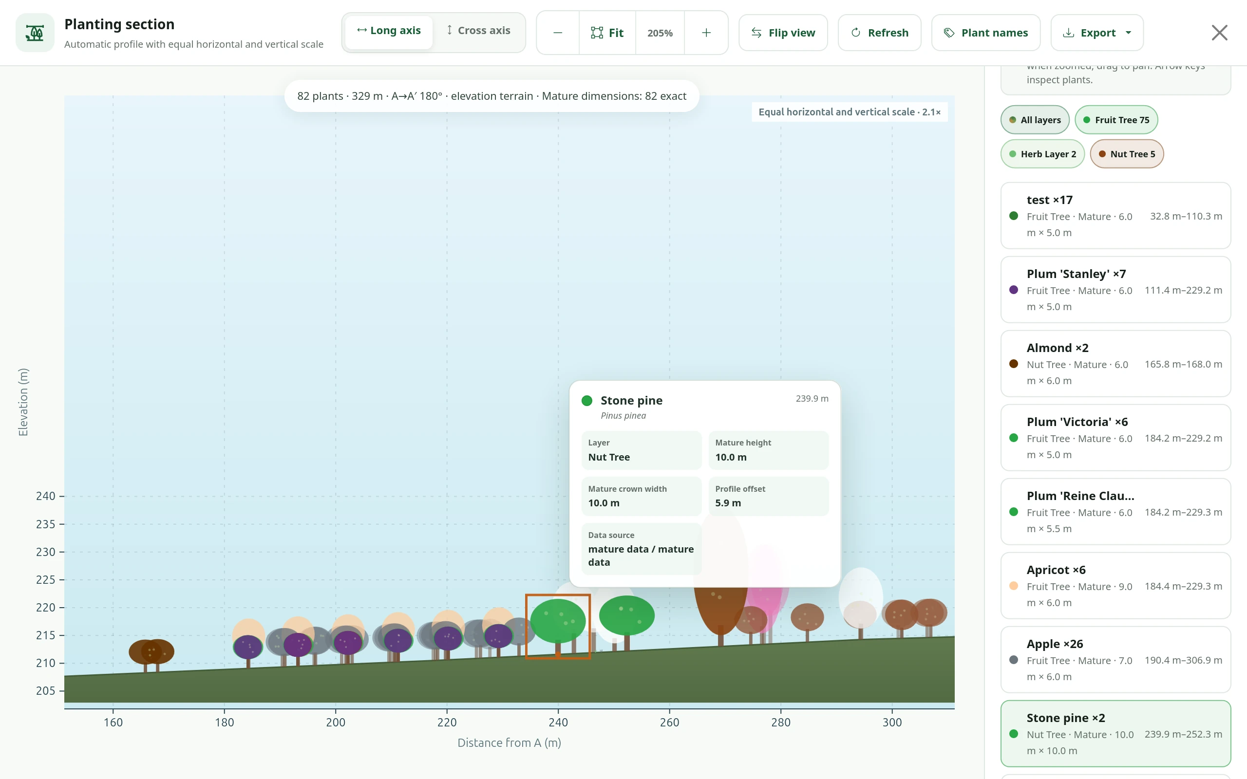
Review mature plant heights, crown widths and terrain elevation together in an exportable profile view.
 Product capture
Review plant positions, mature spread and layout directly on the aerial image.
FAQ
No. It is an indicative model based on mapped plants, raised drawing objects, seasonal leaf cover and sampled daylight hours. Terrain and objects outside the plan are not included.
The current tool visualises sampled elevation as adjustable contour lines. Use verified survey data and local assessment where precise slopes or drainage decisions matter.
Yes. Available output includes plan and plant information intended to support implementation; exact professional formats depend on your plan.
Professional spatial and model exports support selected external workflows.
Your design starts here
Start without payment details. Add capacity or professional features later, when your project needs them.